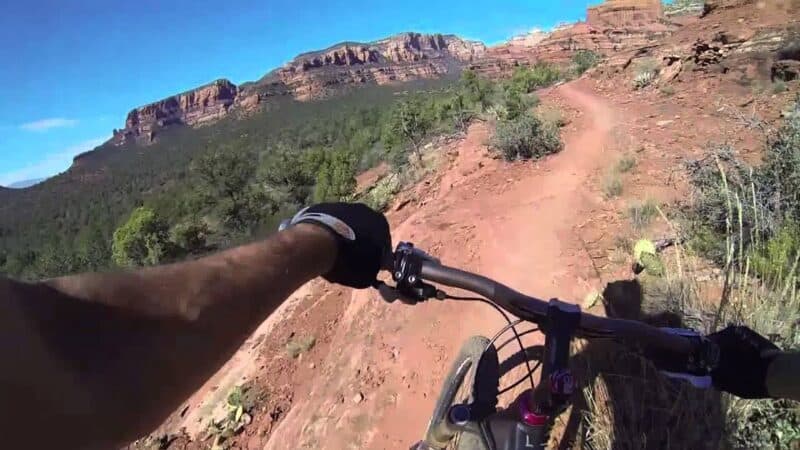
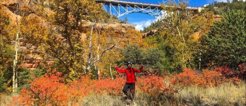
The 20 Best Hiking Trails In Sedona, AZ
Located near Flagstaff, Arizona, Sedona is a beautiful desert town. The main strip is filled with art galleries, museums, new age shops, and restaurants. There are plenty of places to stay overnight and grab a spa day.
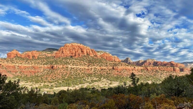
But a short drive in any direction from its town center exists an entirely different world. One where stunning canyons, amazing rock buttes, wildlife, and forests abound. Outdoor enthusiasts will not be disappointed when visiting these areas.
In fact, if you’re a hiker, Sedona has some of the best trails in Arizona. There’s a trail for just about every skill level and interest. Read on for more information on the 20 best hiking trails Sedona has to offer.
1. Fay Canyon
- Length: 2.3 miles
- Difficulty: easy
- Time to complete: 1 – 1/2 hours
- Elevation gain: 193 feet
- Pets Allowed: leashed dogs
- Parking: at the trailhead
- Terrain: mostly flat
- Route: out and back
Fay Canyon is great for people who want or need a shorter hike. There are some rocky areas near the dried up creek beds, but other than that it’s pretty flat, One of the main attractions of the Fay trail is the natural red rock arch about a half mile in to hike. The canyon has a vast array of desert plants.
There’s plenty of shade to be had from the towering Cottonwood trees. It’s a great spot for families with small children or older adults. The hike ends at Supai sandstone cliff, where there are spectacular views of the cliffs that surround the area. This is just one of many great trails located inside of Coconino National Forest.
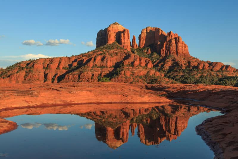
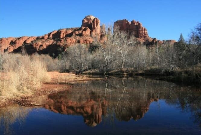
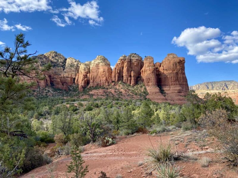
2. Cathedral Rock
- Length; 1.2 miles
- Difficulty: challenging
- Time to complete: 1 hour
- Elevation gain: 741 feet
- Pets: leashed dogs
- Terrain: rocky
- Parking: At the trailhead, Monday to Wednesday only. The shuttle is available on other days.
- Route: out and back
Another trail inside Coconino National Forest. The steep elevation and rocky terrain are what makes this hike pretty difficult. It’s great for experienced hikers that want to see an incredible sunset over the red rock buttes. There are amazing panoramic views all throughout the hike. Wear a pair of good hiking boots for this one.
3. Courthouse Butte Loop
- Length: 3.9 miles
- Difficulty: moderate
- Time to complete: 1-2 hours
- Elevation: 357 feet
- Pets: leashed dogs
- Terrain: steep and rocky at points
- Parking: at the trailhead
- Route: loop
This trail tends to get pretty crowded on the weekends, so consider a mid-week visit. Also, located in Coconino park, a $5 guest pass can be purchased, so any of the trails can be visited.
One of the most popular parts of this hike are Bell rock and Courthouse butte formations. They are great examples of the red rock’s natural beauty that Sedona is famous for.
There’s also a lot of wildlife to view on this hike. There’s just the right amount of up and down on this hike. Make sure to use plenty of sunscreen on this one, as there is very little canopy cover.
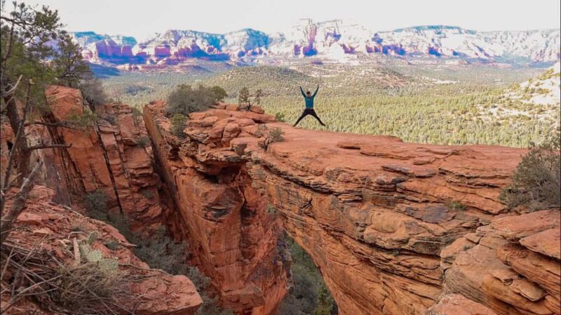
4. Devil’s Bridge Trail
- Length: 1.8 miles
- Difficulty: moderate
- Time: 1-1/2 hours
- Elevation: 400 feet
- Pets: leased dogs
- Terrain: mostly flat, some rocky washes in the middle
- Parking: at the trailhead
- Route: out and back
Located on Dry Creek Road in Sedona, this trail has the largest sandstone arch in all of Sedona. The hike is fairly easy until the end where the elevation becomes quite steep. But the views at the top will leave you breathless.
About halfway through, there are some washes that are filled with prickly pear cactus and juniper trees. The trail has beautiful scenery and is filled with wild flowers.
There are even a few caves if you’re adventurous enough to go off the trail. Toward the end of the hike there is a unique natural rock staircase. It will lead hikers to a flat where the view is simply stunning. There is very little shade. Bring a hat and plenty of water.
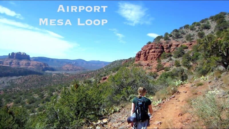
5. Airport Mesa Trail
- Length: 3.5 miles
- Difficulty: moderate
- Time: 2 hours
- Elevation gain: 314 feet
- Pets: not recommended
- Terrain: rocky in some sections
- Parking: at the trailhead
- Route: loop
Located on Airport Rd., this trail is deemed moderate due to its length. Basically, it’s a hike for people that don’t do much walking and a nice walk for experienced hikers. There are great views of Bell rock and Courthouse butte along the way.
The red rock formations are beautiful any time of day, but are amazing at sunset. Bring lots of water and sunscreen, as there is no shade for most of the hike.
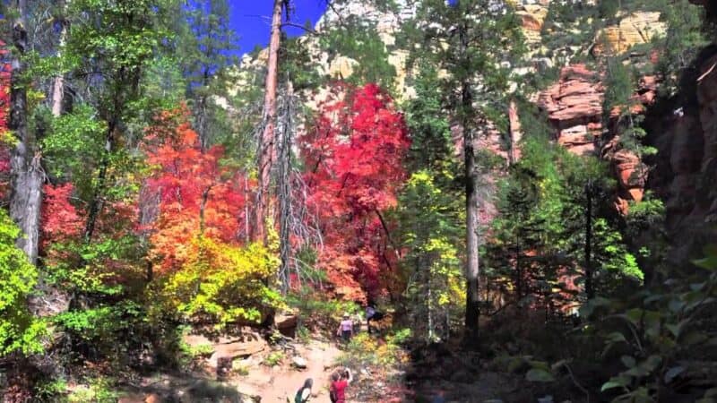
6. West Fork Trail
- Length: 8 miles
- Difficulty: moderate
- Time: 3 hours
- Elevation: 1129 feet
- Pets: leashed dogs
- Terrain: mostly flat, some rocky areas
- Parking: at the trailhead
- Route: out and back
A peaceful hike inside Coconino National Forest. It’s great for those who want to get their feet wet. The trail runs along beautiful Oak Creek and crosses it several times. The trail is diverse in scenery, from huge canyon walls to lush forests.
One of the most picturesque trails to be found in all of Sedona. There are foot bridges and even an old hunting lodge. It was here that author Zane Grey wrote the novel, Call of the Canyon. A movie was made from the book and filmed at West Fork as well. Not only is the hike great, but it’s a great place to stop and relax. Bring water shoes!
7. Brins Mesa Trail
- Length: 4.5 miles
- Difficulty: moderate
- Time: 2 hours
- Elevation: 951 feet
- Pets: leashed dogs
- Terrain: flat
- Parking: in town
- Route: out and back
Brins Mesa is trail number 119 inside the Coconino forest. It’s beautiful and convenient as it starts right at the edge of town. This trail is unique to the park as it is wide open and hikers immediately get a great view of the famous Sedona red rock formations.
There are several interesting rocks along the trail, including Coffee Pot Rock, Chimney Rock, and Wilson mountain. The area is filled with many species of birds to admire. One of the less crowded trails in the park, so it’s great for people who want to take their time.

8. Bear Mountain
- Length: 4.9 miles
- Difficulty: Challenging
- Time: 3-1/2 hours
- Elevation: 2024 feet
- Pets: not recommended
- Terrain: rocky and rugged
- Parking: at trailhead
- Route: out and back
This trail is number 54 within the Coconino National Park. It’s one of the most challenging hikes to experience in the area. There’s very little shade and it gets windy. Bring plenty of water and snacks as it’s pretty strenuous, even for avid hikers.
However, the scenery is beautiful and the view from the summits is breathtaking. There’s also plenty of wildlife to experience along the way.
9. Mescal Mountain Trail
- Length: 2.4 miles
- Difficulty: moderate
- Time: 2-1/2 hours
- Elevation: 521 feet
- Pets: leashed dogs
- Terrain: rugged and rocky
- Parking: at trailhead
- Route: loop
Located on Long Canyon Rd. in Northeastern Sedona, this trail may be difficult for people not used to hiking. Several areas are rocky and have boulders. The area is rich with desert wildlife like snakes, lizards, and even butterflies. There are several species of cactus to admire as well. The hike itself is invigorating and the views of the red rocks throughout the hike are great.
10. Soldiers Pass Trail
- Length: 4.5 miles
- Difficulty: easy to moderate
- Time: 2-1/2 hours
- Elevation: 839 feet
- Pets: n/a
- Terrain: mostly flat, some rocks
- Route: out and back
Labeled trail number 66 inside the Coconino National Park, this trail offers hikers of all skill levels many adventures. The trail begins in an urban setting, but eventually leads to red, rocky wilderness. Hikers will pass the Seven Sacred Pools ( small pools of water that go deep into the canyon rock.
After that, a forested area full of cypress and wildlife will appear. There’s some great shade here and a nice place to take a break. If you want to go off the trail,there’s the secret Soldier’s Pass Cave just past the pools.
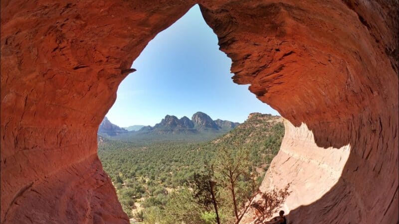
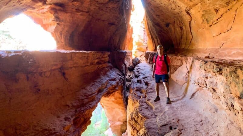
11. Birthing CaveTrail
- Length: 2 miles
- Difficulty: easy
- Time: 1 hour
- Elevation: 250 feet
- Pets: leashed dogs
- Terrain: flat
- Parking: small lot at trailhead
- Route: out and back
Located in Western Sedona, this trail is quite popular and therefore usually crowded. This wide, sandy trail is flat and a great place for photos. The view of the cliffs is fantastic from the top. The trail to the cave is pretty straight forward and hard to miss. The climb to the cave is of moderate difficulty.
Once in the cave, you will find spectacular views of the famous Sedona red rocks. Inside the cave, the walls are slick and there’s not much to hang on to do and use caution. A good pair of hiking shoes will be needed.
12. Boynton Canyon
- Length: 2 miles
- Difficulty: easy
- Time: 2 hours
- Elevation: 291 feet
- Pets: leashed dogs
- Terrain: flat with some rocky sections
- Parking: at trailhead
- Route: out and back
Inside Coconino park, this relatively easy hike is the 2nd most popular in Sedona. It’s a mostly flat surface that’s shaded from the sun’s rays. There are 2 detours that can be taken if you choose a bit more adventure. A cave is just off the trail and Sinagua ruins (a sacred site).
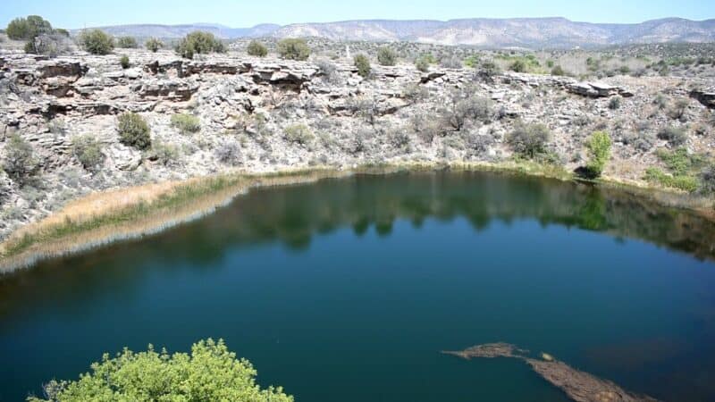
13. Montezuma Well Trail
- Length: 0.7 miles
- Difficulty: easy
- Time: 15-20 minutes
- Elevation: 62 feet
- Pets: leashed dogs
- Terrain: flat and paved
- Parking: at trailhead
- Route: loop
Located near Montezuma lake on the Sedona outskirts, this short hike is great for everyone. The trail is paved, so it’s great for strollers, wheelchairs, and other motorized assistance. There are even benches along the trail. Surrounded by the trail is a natural well that releases fossil water into the desert. It’s a historic site that contains ancient ruins for visitors to respectfully explore.
14. Doe Mountain
- Length: 1.2 miles
- Difficulty: moderate
- Time: 1 hour
- Elevation: 511 feet
- Pets: leashed dogs
- Terrain: rocky
- Parking: Red Rocks parking pass required
- Route: out and back
This pretty basic trail is number 60 inside of Coconino forest. It’s a bit rocky in most spots, but not bad for the average hiker. The summit is not too far from the base. Once you reach the top of the Mesa, there’s a space to stroll around, take a rest, and view the gorgeous canyons and rock formations.
If you get there early enough, there are hot air balloons that take off each morning that can be seen from the top of the trail.
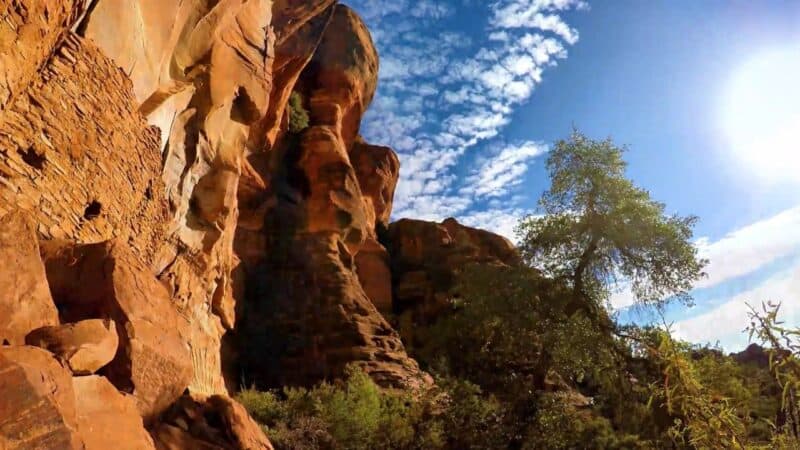
15. Palatki Heritage Site Trail
- Length: 1-1/2 miles
- Difficulty: easy
- Time: 30 minutes
- Elevation: 112 feet
- Pets: no
- Terrain: flat
- Parking: at trailhead
- Route: out and back
The Palatki Ruins and Heritage site has three separate trails that lead to it. One is shaded and another is wheelchair accessible. At the end of the tranquil hike, visitors will be humbled by ancient pictographs and cliff dwellings that were home to native people for thousands of years.
Due to the cultural significance of the ruins, the hikes are guided by forest rangers. Reservations are needed for groups no larger than 12.
![]()
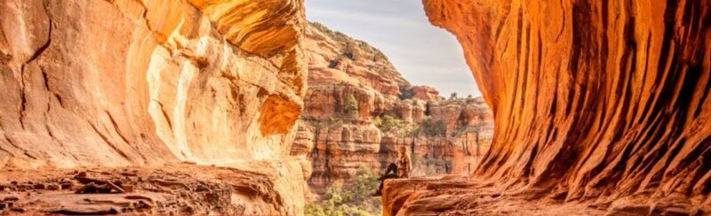
16. Broken Arrow Trail
- Length: 2.8 miles
- Difficulty: moderate
- Time: 1-1/2 hours
- Elevation: 413 feet
- Pets: leashed dogs
- Terrain: rocky
- Parking: at trailhead
- Route: out and back
This trail is moderately difficult for less experienced hikers. This is number 125 on the list of trails inside Coconino National Forest.There are rocky parts and not much shade. However, there are some great formations along the trail, like Submarine rock and The Devil’s Diningroom sinkhole.
There’s a ton of wildlife, from snakes to birds. Jeep tours are given, so hikers get to watch and listen along the trail. Cathedral rock in Coconino forest can be seen from this spot as well. Perhaps the best part is the bat cave at the start of the trail. Depending on how one feels about bats.
17. Red Rock Crossing Trail
- Length: 1 mile
- Difficulty: easy
- Time: 20 minutes
- Elevation: 65 feet
- Pets: leashed dogs
- Terrain: hills, flat
- Parking: available throughout the park
- Route: loop
Situated inside Red Rock State Park, the trail and surrounding area combine country charm and rugged scenery. Though the actual hike is pretty relaxing and gentle on the body.
The trail runs along Oak Creek where hikers can stop and rest on one of the many large, flat rocks. Sunbathe or even go for a dip in the creek. The trail itself is lovely as it winds in and out of the forest. There’s plenty of wildlife to watch and relax around. This is a great spot for kids and people that don’t normally hike.
18. Huckaby Trail
- Length: 5.7 miles
- Difficulty: moderate
- Time: 2-1/2 hours
- Elevation: 902 feet
- Pets: leashed dogs
- Terrain: rocky
- Parking: Red Rock pass required
- Route: out and back
Huckaby is trail number 161 in Coconino forest. The hike is a bit steep and rocky, so it’s good to be an experienced hiker for this one. It does pay off with great views of uptown Sedona, Buttes, and Oak Creek Canyon. The trail does cross the creek, so bring water shoes.

19. Little Horse Trail
- Length: 4.3 miles
- Difficulty: moderate
- Time; 2 hours
- Parking: limited
- Elevation: 564 feet
- Pets: leashed dogs
- Terrain: flat, rocky
- Route: out and back
There’s plenty of natural beauty to be had along trail number 61 in the National Forest. From wildlife and plant life to dry stream beds and unique rock formations. It’s known for the Madonna and the Nuns formation near a historic chapel on the trail.
The end of the hike is a bit tricky as it involves climbing bare rock. But if you can do it, the views of Sedona, the valleys, and red rocks are worth it.
20. Sugarloaf Loop
- Length: 1.6 miles
- Difficulty: easy
- Time; 45 minutes
- Patking: limited
- Elevation: 222 feet
- Pets: leashed dogs
- Terrain: hills
- Route: loop
Though it’s categorized as an “easy” hike, there are lots of ups and downs on the rocks. People who have hiked this trail recommend taking hiking poles. There’s plenty of wildlife to see along the trail and plenty of scenery as well. The summit is a little difficult but worth it for the view.
You can also read:
- How to Find Dog Friendly Hiking Trails Near You
- The 10 Best Hiking Trails In Los Angeles
- The 50 Best Hiking Trails in Europe


