The 20 Best Hiking Trails in Austin

Austin isn’t well known for hiking, but it should be. Austin might be a metropolitan area, but there’s easy access to nature in every part of the city. If you want to get away from the city life, hiking trails in Austin are the perfect solution.
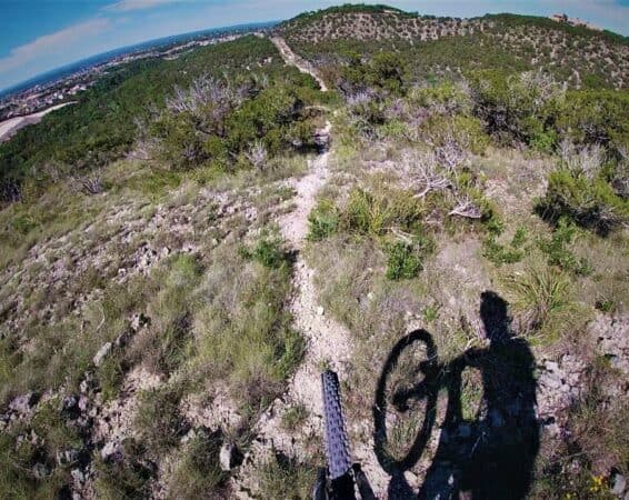
1. Barton Creek Greenbelt Trail Head
- Difficulty: Easy
- Length: 1.2 Miles
The Barton Creek Greenbelt spans 12 miles of hiking trails in South Austin. The Trail Head is an easy 1.2 mile hike. Most of the Greenbelt goes through forests, but this portion is open.
More adventurous hikers can explore the other trails, which lead to several swimming areas and even rock walls perfect for climbing.
2. Violet Crown Trail 360 to 290
- Difficulty: Easy
- Length: 1.8 miles
Violet Crown Trail features a stunning 30 miles of trails throughout Austin. This particular trail is an easy 1.8 mile hike over even terrain. For more fun, you can take spur trails that lead to the creek.
Dogs are allowed on the trail, as long as they are leashed.
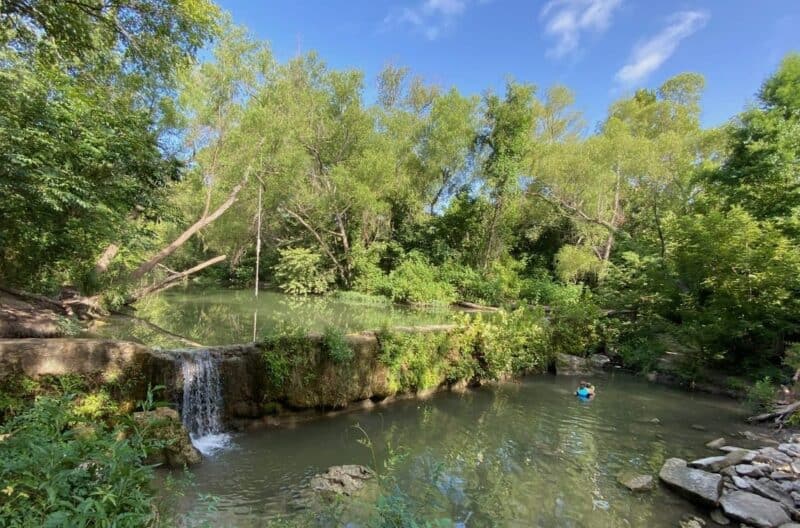
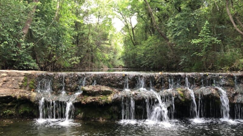
3. Bull Creek South to North
- Difficulty: Easy to Moderate
- Length: 3.8 miles
Bull Creek offers a trail that crosses Bull Creek, and gives you an excellent view of a waterfall. Recent hikers state that the trail is fun, but the route isn’t well marked.
You may end up choosing an unintended route due to this, but the trails generally lead back into each other, which makes this less of a concern.
The actual concern with Bull Creek is that hikers state cars are frequently broken into in the parking lot. They also state that areas of the park often have trash or debris.
The main trail is considered easy. However, some of the side trails may be moderate.

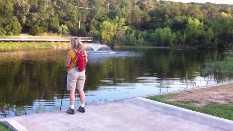
4. Northern Walnut Creek Trail
- Difficulty: Easy to moderate
- Length: 9 miles
The Northern Walnut Creek Trail is located in Walnut Creek Metro Park. This area in North Austin is a 293 acre park.
The main trail is considered easy, and is paved. Side trails may offer more of a challenge and not be paved. The length does pose a challenge for hikers, being nearly 9 miles in length.
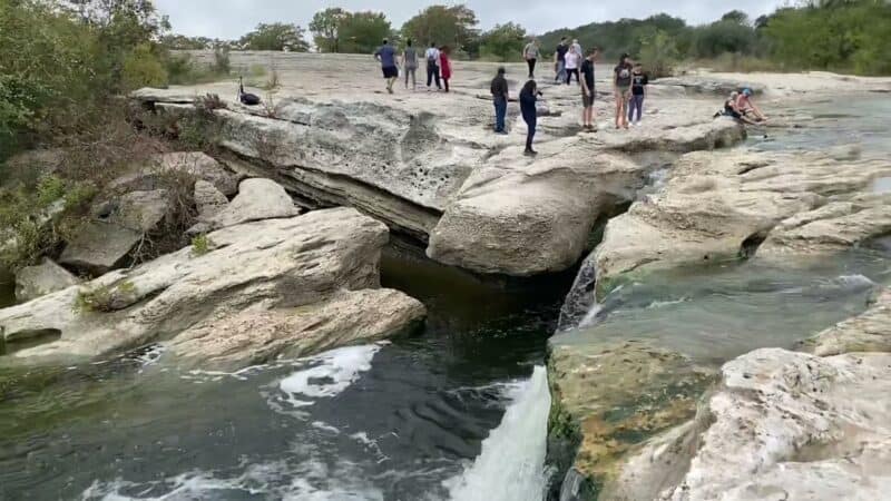
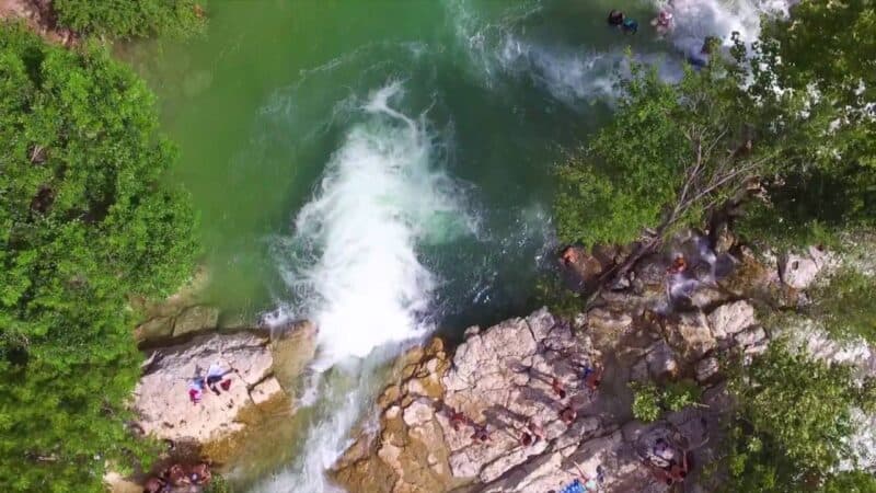
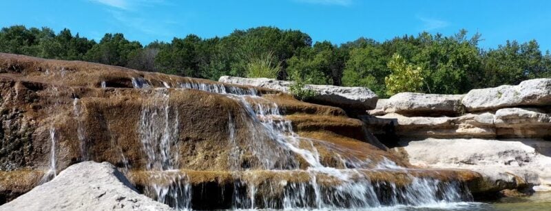
5. Onion Creek and Homestead Trail Loop
- Difficulty: Moderate
- Length: 6.8 miles
The Onion Creek and Homestead Trail Loop is located in Mckinney Falls State Park. The park is popular for hiking, birdwatching, and bike riding.
The Onion Creek Trail gains 390 feet of elevation, and takes about 2 and a half hours for most hikers to complete. You’ll encounter a creek crossing, and interesting rock formations along the hike.

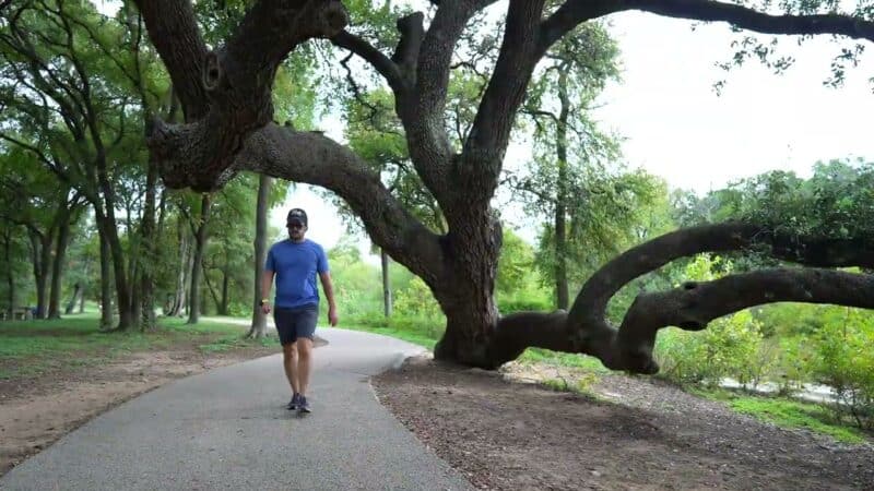
6. Anne and Roy Butler Hike and Bike Trail
Difficulty: Easy to Moderate
Length: 10 miles
The Anne and Roy Butler Hike and Bike Trail is located at Lady Bird Lake. The trail is easy, and accommodates hikers, runners, and cyclists.
The full trail is 10 miles. However, it offers a lot of options. There are many access points along the trail, so you can hike the entire length, or a short distance of the trail.
The trail offers amenities, including water fountains and rest rooms, at many way points along the trail. You can enjoy the cool water of Barton Springs, or check out the bat observatory along the trail.
7. Mayfield Preserve and Mount Bonnell
- Difficulty: Easy to Moderate
- Length: .05 to 10 miles
Mayfield Preserve and Mount Bonnell are technically two separate parks, but you’ll want to hike them both if you’re in West Austin.
Start by making your way to the top of Mount Bonnell. This .5 mile hike is moderate in difficulty, because of the steep elevation change. You can also brave over 100 steps to reach the top.
From there, head to the Mayfield Preserve. You can hike, drive, or ride to the preserve. Enjoy Mayfield’s 23 acres of natural beauty, and don’t miss the peacocks the park is famous for. For an easy hike, consider taking the lake trail once you reach the preserve.
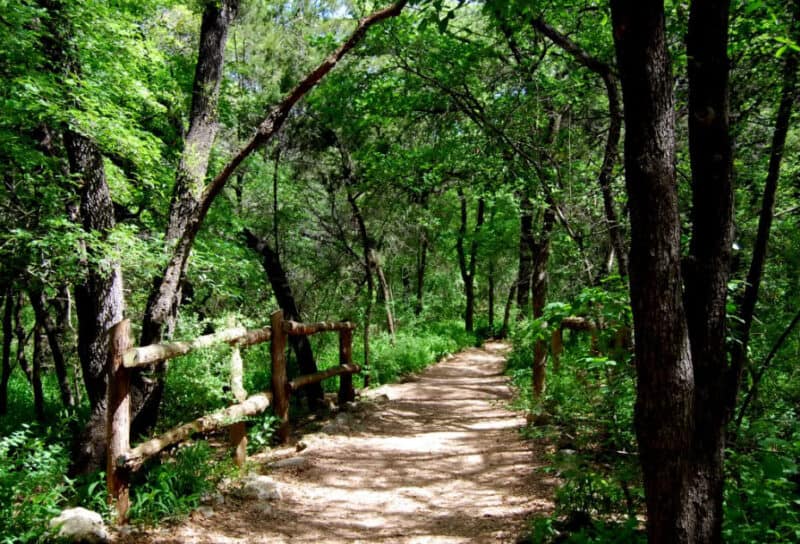
8. Laurel, Yaupon, Possum, and Arroyo Loop
- Difficulty: Moderate
- Length: 1.8 miles
The Laurel, Yaupon, Possum, and Arroyo Loop is located within the Wild Basin Wilderness Preserve. The trail is considered moderate, and can be hiked in under an hour.
The trail goes around the perimeter of the park, and offers beautiful views. Despite the short length, the steep climbs and descents offer a challenge when hiking.
You’ll encounter a few creeks during the hike. Benches are provided near areas of elevation changes so you can take a rest if needed. If you want to take a longer route, this trail connects with other trails in the Wild Basin Preserve.
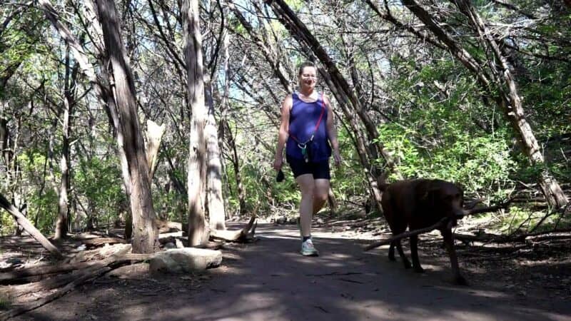
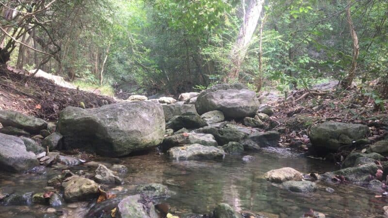
9. Turkey Creek Trail
- Difficulty: Moderate
- Length: 2.8 miles
Turkey Creek Trail is adjacent to Emma Long Park. It features a few creek crossings and beautiful limestone cliffs. The trail is 2.8 miles long, and is near Lake Austin.
Dogs are welcome on the trail, and may be off leash. Cycling is not allowed. You’ll encounter some moderately challenging terrain, including exposed roots on the trail.
If you want a longer route, there are some side trails that you can take off the main trail. You’ll want to follow the trail markers closely. It’s recommended to take a photo of the map at the trailhead, because some areas are not well marked.
Turkey Creek Trail is free, but Emma Park charges an admission fee.
10. Slaughter Creek Trail
- Difficulty: Easy to Moderate
- Length: 4.9 miles
Slaughter Creek Trail is considered an easy trail, but there are a few areas that may be considered moderate in difficulty. There’s little shade along the trail, so consider going early during the summer months.
Dogs are not allowed on the trail. Hikers, horse riders, and cyclists are welcome, so you’ll need to keep an eye out for bikes, particularly around sharp corners.
Bikers go clockwise around the trail. Hikers and horseback riders go counter clockwise.
The trail is nearly 5 miles long. However, a bypass that shortens the trail is provided. If you take the bypass, the trail is 3.5 miles long.
11. St. Edwards Green and Red Loop
- Difficulty: Moderate
- Length: 2.7 miles
St. Edwards Green and Red Loop is located in St. Edwards Park. This 2.7 mile loop is considered a moderate hike. You’ll encounter rocky areas, and some areas that require a steep climb. The scenery includes open fields with cacti and juniper forests.
You’ll encounter a creek, which is perfect for swimming. Because many sections of the trail provide little shade, sun protection is advised. Dogs are allowed on a leash.
Reviewers state that the trails are not always well marked, which can make it easy to get lost. However, the park and trail system are relatively small, so you will find your way back out eventually.
If you are concerned, bring a map or use an app to keep you on the right track.
12. Shoal Creek Greenbelt
- Difficulty: Easy
- Length: 5.5 miles
The Shoal Creek Greenbelt is located in the heart of downtown Austin. Much of the path is paved, with the rest being gravel. It’s ideal for hikers and bikers. It’s considered family friendly, and strollers can be be used on the trail.
Some areas are near to Austin streets, while other areas feature tree tunnels that provide a little bit of nature.
If you don’t want to hike the entire 5.5 mile trail, there are many access points and parking areas near the trail.

13. Lady Bird Lake Trail
- Difficulty: Easy
- Length: 10 miles
As the name suggests, Lady Bird Lake Trail winds its way around Laedy Bird Lake. The entire trail is paved. It’s great for hiking, cycling, or running.
It’s also considered stroller and wheelchair accessible. The majority of the trail is flat or gently sloping, with less than a 5% grade. Near the end of the trail there is a steeper section. Those with wheelchairs or strollers need to use caution or avoid this section due to the grade.
The trail offers the best of city and nature. You’ll find areas with local businesses to pick up a meal, and stroll alongside the Colorado River.
14. River Place Canyon Trail
- Difficulty: Moderate
- Length: 5.4 miles
The River Place Canyon Trail has an elevation gain of over 800 feet, which makes it a moderately challenging hike. You can expect a lot of stairs. Portions of the trail are narrow, and terrain is uneven.
You’ll encounter some great views along the way. You’ll cross several streams. There are lots of offshoots and lookout points along the trail. Dogs are allowed on leashes.

15. Mary Moore Searight Park Trail
- Difficulty: Easy
- Length: 2.1 miles
The Mary Moore Searight Park Trail is a trail within Mary Moore Searight Park. Part of the trail is paved, but portions are dirt. It’s an easy trail, perfect for hiking or running.
The trail is not well marked in some areas, so a map or app are recommended to keep you on track. If you are adventurous, there are side trails that you can explore.
Hikers say there are many areas suitable for picnicking or fishing. The trail is for hikers, but it does intersect with bike trails in some areas. Dogs on leashes are allowed.
16. Great Hills Park Trail
- Difficulty: Easy
- Length: 1.5 miles
The Great Hills Park Trail in Great Hills Neighborhood Park is a hidden gem in Austin. It has a surprising amount of wildlife, despite part of the trail going through a local neighborhood.
There’s little to no official parking, but many hikers simply pull off the road near the trail. The terrain is varied, with some hills. However, it’s considered an easy trail and has little elevation change.
There are creek crossings, so be prepared to get your feet wet.
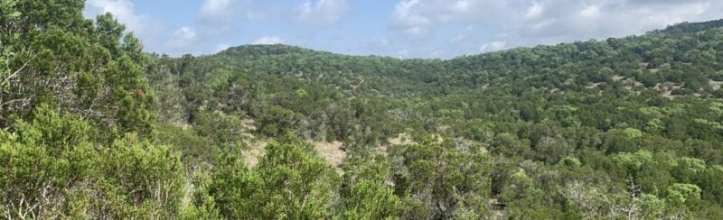
17. Mount Lakeway Trail
- Difficulty: Moderate
- Length: 4.3 miles
The Mount Lakeway Trail offers a challenge for avid hikers. It has an elevation gain of nearly 1,000 feet. The terrain varies from rocky areas, woodland, and exposed hilltops that make it well worth the steep climb.
The trail is very poorly marked, so you’ll need a map or an app to avoid getting lost. However, the side trails can make the hike longer and more interesting if you want to take a longer route.
18. Mount Bonnell Trail
- Difficulty: Easy
- Length: .5 miles
The Mount Bonnell Trail is very short. You’ll climb a lot of stairs to get to the viewing area at the top of the mountain. You’ll get a great view of Austin and the Colorado River. In fact, Mount Bonnell is considered the highest point in Austin.
If you want a longer hike, there are lots of unofficial trails that lead to the cliff edge.
Hikers do say that thieves are a problem in the area. Some recommend not leaving your car unattended, because windows are broken and things are stolen from cars regularly.
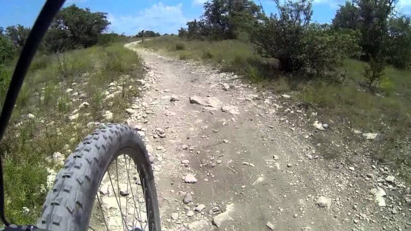
19. Spicewood Valley Trail
- Difficulty: Moderate
- Length: 2.1 miles
The Spicewood Valley Trail is a little known trail in Austin. It’s a great trail for those new to hiking or trail running. There are only two parking spots at the south trail head. However, there are other entry points as well.
For a shorter hike, you can begin in Mountain View Park.
You’ll encounter some rocky terrain and lots of exposed roots. Though it is considered a moderate trail, it’s still relatively easy.

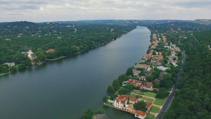
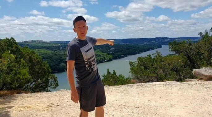
20. Lake Austin/360 Bridge Overlook
- Difficulty: Moderate
- Length: .5 miles
The 360 Bridge Overlook Trail is considered moderate, because it is steep and rocky. However, experienced hikers can make it up the trail easily. It provides a great view of Lake Austin, Downtown, and the bridge.
Hikers state that if you go beyond the official trail, you can find another great lookout spot that offers more privacy.
Unfortunately, there are many vehicle break ins that occur here. There’s also a lot of broken glass and trash, which detracts from the natural beauty of the area.
You can also read:


