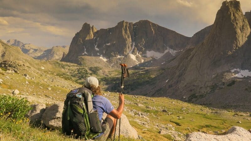
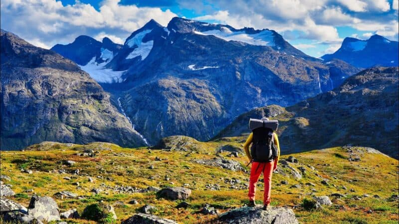
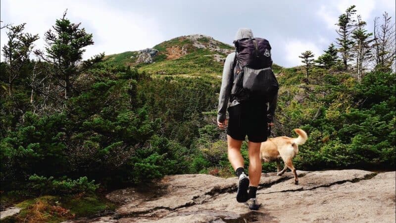
The 50 Best Hiking Trails in North America
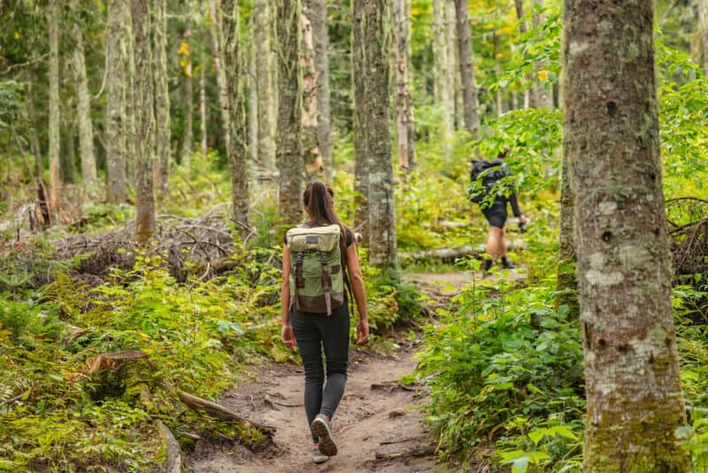
If you know where to look, there are some truly spectacular hiking trails in North America, and millions of people have discovered the joys of walking these trails alone, either on a trek of a few hours, or one that lasts several days or weeks. There is much to be seen on the continent that is breath-taking, inspiring, and just plain beautiful.
This listing will identify 50 of the most intriguing trails you could possibly embark on to satisfy the wanderlust in you, and to scratch the itch you have for witnessing the marvels of the natural world. If you get a chance to check out some of the trails we’ve described below, we think you’ll agree that they belong in this list of the best hiking trails to be found on the North American continent.
According to Morgan Travel, these are some of the very best hikes you can pursue in North America.

1. Fire Wave Trail
Location: Overton, Nevada Distance: 1.5 miles Difficulty: Easy Time: 1-2 hours
This is both a short hike and a relatively short one, so it’s a good one to take the whole family on, if you can get them up early in the morning for the hike. What makes this hike really compelling is the alien landscapes that you’ll encounter, which look very much like something you’d see in the Martian environment. The trail terminates at the Valley of Fire State Park which is fairly close to the city of Las Vegas. If you can get your fellow hikers up early in the morning, you’ll be able to witness the sunrise bathing this captivating landscape in the soft light of morning, which will make the whole hike worthwhile.

2. Guadalupe Peak Trail
Location: Pine Springs, Texas Distance: 8.5 miles Difficulty: Strenuous Time: 5-6 hours
Be ready for a climb if you’re going to take on this hiking trail, because it leads to the highest point in the state of Texas, and that includes a 3,000 ft. elevation gain over the space of four miles on the way to the summit. This trail leads to Guadalupe Mountains National Park, and when you reach the summit, you’ll be 8,750 feet above sea level, witnessing a truly inspirational environment before you. If you can time your summit for either dawn or dusk, you’ll have some awesome photo opportunities, and you’ll be able to witness vistas that include desert stretching for miles and mountains that seem endless.
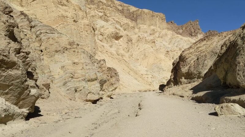
3. Golden Canyon Trail
Location: Furnace Creek, California Distance: 7.8 miles Difficulty: Strenuous Time: 5-6 hours
The Golden Canyon Trail is the premiere hiking trail in Death Valley National Park. The full trail is 7.8 miles long, but you can choose various sections of the trail to suit your time availability, hiking skills, and your specific interests. There are several key points of interest along the trail, including the Badlands Loop, Gower Gulch, Zabriskie Point, and Red Cathedral.
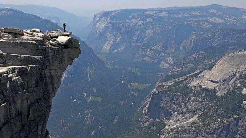
4. Half Dome Hike
Location: Yosemite Valley, California Distance: 16 miles Difficulty: Very Strenuous Time: 16 hours
This is a hike that only people in a great state of fitness should tackle, because it has some very demanding terrain along most of the route. This hike is entirely contained within Yosemite National Park and if you do the entire loop of the hike, you’ll have to use some cables to reach the Half Dome summit at the end. Along the way, you’ll see both Nevada Falls and Vernal Falls, which are sites worthy of much attention. This is one of the most challenging hikes on our list, but the rewards you get are a spectacular view of the Half Dome Summit, as well as the entire Yosemite Valley.
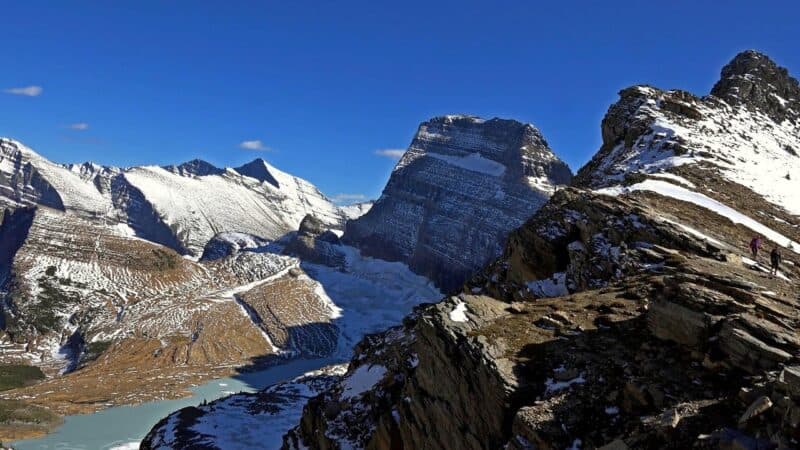
5. Highline Trail
Location: St. Mary, Montana Distance: 11.6 Difficulty: Moderate Time: 6-7 hours
This is a very well-known hike entirely contained within Glacier National Park in Montana. This gorgeous National Park certainly doesn’t lack for beautiful scenery, and there’s a little adventure included as well. When you get to the section of the trail called The Garden Wall, you may be forced to confront your fear of heights, standing high above the valley below on a narrow ledge. All in all, one of the most gorgeous hikes for scenery you can take in the continental United States.

6. Hollywood Sign Trail
Location: Los Angeles, California Distance: 6.4 miles Difficulty: Strenuous Time: 4 hours
Everyone has seen the Hollywood sign perched on a hillside outside the city of Los Angeles. There are actually a handful of trails available to see this sign from a number of different vantage points. The best one is the 6.4 mile loop running through Griffith Park that summits at Mount Lee, which is directly behind the Hollywood sign. Taking this hike will give you a close-up view of the famous Hollywood sign, and it will also allow you to get a bird’s eye view of the entire city of Los Angeles.
7. John Muir Trail
Location: California Distance: 214 miles Difficulty: Strenuous Time: 3-4 weeks
This is a hike not for the faint of heart, if only because of the huge distance involved. Along the way, you will have occasion to observe some of the most impressive 14,000 ft. high mountains in the American landscape. This is a popular hike along the Sierra Nevada mountains, and it’s one that is absolutely unforgettable for anyone who has undertaken it. By sticking to a regular schedule and taking breaks whenever necessary, the trail can be completed in three to four weeks.
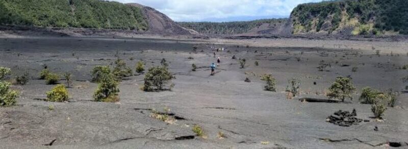
8. Kilauea Iki Trail
Location: Volcano, Hawaii Distance: 6 miles Difficulty: Moderate Time: 2-4 hours
This hike is situated on the big island in Hawaii Volcanoes National Park. You’ll begin your hike at Devastation Trailhead and pursue the six-mile loop that takes you through Kilauea Iki, Nahuku Lava Tube, and Uealoha. You may be treated to some billowing steam that issues through cracks in the lava bed that you’re hiking on, as you complete this hiking trail.

9. Lost Mine Trail
Location: Terlingua, Texas Distance: 4.8 miles Difficulty: Strenuous Time: 5 hours
This is a very popular hiking trail which is contained in Big Bend National Park, situated in the state of Texas. The trail passes through the Chisos Mountains and opens up on spectacular vistas of Juniper Canyon and Casa Grande. This is one of the most spectacular hikes you can take in the state of Texas, and it’s best begun in the early part of the day, so you avoid the excessive heat of the daytime hours.
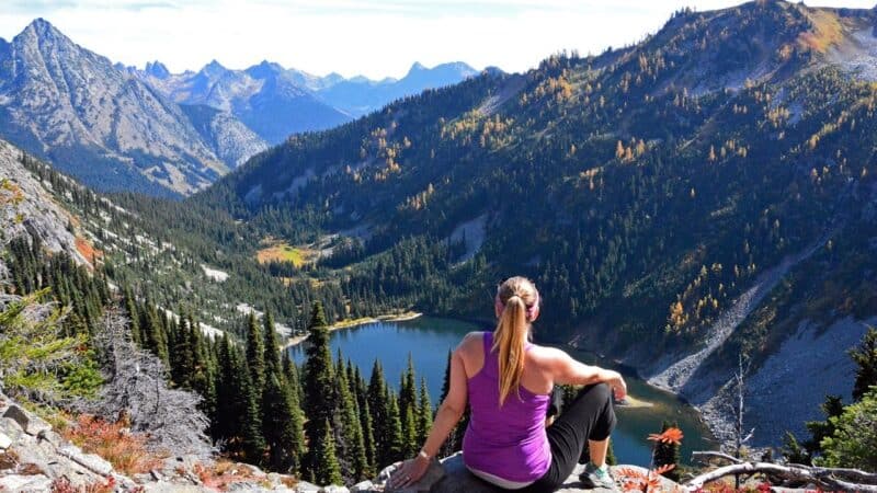
10. Maple Loop Pass Trail
Location: Winthrop, Washington Distance: 7.2 miles Difficulty: Strenuous Time: 5 hours
This hiking trail passes through the North Cascades National Park in the state of Washington. You can walk this loop in either direction, but most hikers generally take the counterclockwise approach, which includes a more gradual ascent. It will also have terrific views of Black Peak, right at the pass itself. This National Park is exceptionally beautiful in scenery, and the Maple Loop Pass is easily the most attractive hiking trail contained within the National Park.
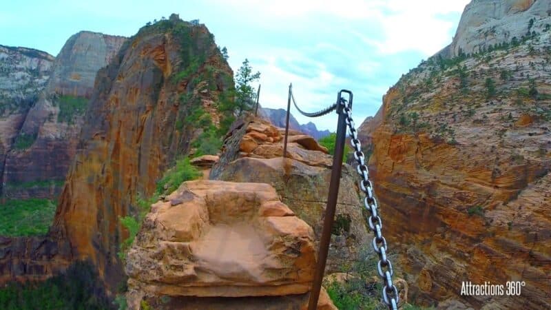
11. Angels Landing Trail
Location: Springdale, Utah Distance: 2.7 miles Difficulty: Strenuous Time: 3 hours
This hiking trail has a reputation for being somewhat dangerous, but it’s also one of the most exhilarating hikes you can embark on. Contained within Zion National Park, hikers are obliged to climb up a steep rock formation that looks very much like a shark fin and has drops on either side that lead to the Angel’s Landing Summit. This is one of those hikes that will really take your breath away and will provide you with some heart-pounding moments, but the scariness of the adventure is offset by the beauty of Zion National Park.
12. Appalachian Trail
Location: Maine and Georgia Distance: 2,194 miles Difficulty: Very Strenuous Time: 5-7 months
According to Backpacker’s Tale, this is a hike that is famous around the world and has been attempted by a great many hikers. You can either start this hike in Maine or Georgia, but in either case, it will take you a half year of hiking to traverse the 14 coastal states of the eastern U.S. This is one of the great American adventures you could ever undertake, and it will test your physical and mental abilities to the maximum. It’s not overstating the case to say that this would literally be the hike of a lifetime for any hiking enthusiast.
13. Artists Bluff Trail
Location: Franconia, New Hampshire Distance: .5 miles Difficulty: Easy Time: 1-2 hours
If you can time your hike through Artists Bluff Trail for the fall, you can see some of the most spectacular fall foliage in all of New England. This is a short but fairly steep climb that leads to a rock formation overlooking Echo Lake, and all of this is included in Franconia Notch State Park. If you like, you can choose to include Bald Mountain in your loop to lengthen your hiking trail considerably. If you’re someone who appreciates the turning of color for autumn leaves, you’ll love being surrounded by the radiant colors of all the fall foliage around Echo Lake.
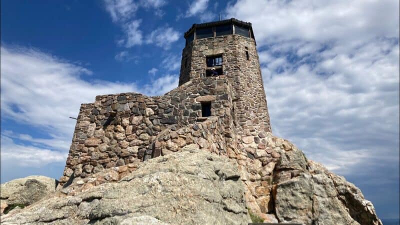
14. Black Elk Peak Trail
Location: Custer, South Dakota Distance: 7 miles Difficulty: Moderate Time: 5 hours
Black Elk Peak is one of the highest points in all of the Black Hills, and also one of the highest peaks east of the Rocky Mountains for that matter. When you reach the Harney Peak Watchtower, you’ll be able to observe parts of Montana, South Dakota, Wyoming, and Nebraska, all from the place where you stand. This is a very scenic hike which includes 360-degree views over four states, and you’ll literally see an ocean of yellow and green for as far as your eyes can observe.
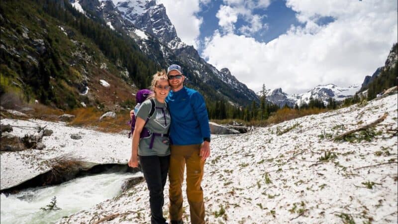
15. Cascade Canyon Trail
Location: Jackson, Wyoming Distance: 9.4 miles Difficulty: Strenuous Time: 9 hours
This hiking trail is situated entirely in Grand Teton National Park, Wyoming. You can take a boat shuttle to the starting point if you want, or you can hike around Jenny Lake, and from there you can enjoy a hike to Hidden Falls and Inspiration Point. Then you’ll have an out-and-back hike into a rock formation known as Cascade Canyon. While in the canyon, you’re quite likely to encounter moose, bears, and other forms of wildlife that will provide great photo opportunities. This might be a good trail to take the whole family on, especially if they’ve done some strenuous hikes before.

16. Cathedral Rock Trail
Location: Sedona, Arizona Distance: 1.2 miles Difficulty: Strenuous Time: 2 hours
Cathedral Rock is a red rock formation directly in the heart of Sedona, Arizona, and it should be at the top of your list for places to visit in that state. There are a number of fantastic hikes in Sedona where you can glimpse spectacular sunrises and sunsets. If you time your hike for one of those times, you certainly won’t be disappointed. Of all the trails in the area around Sedona, Cathedral Rock is by far the most impressive and majestic, and it’s a hike you just won’t want to miss.
17. Continental Divide Trail
Location: Montana and New Mexico Distance: 3,100 miles Difficulty: Very Strenuous Time: 6 months
There are a whopping 3,000 miles included in this hike, which literally runs from the border of Canada all the way south to the Mexican border. Along the way, you’ll pass through five different states, and this is probably one of the most isolated long hikes you can take on the entire North American continent. This is a once-in-a-lifetime opportunity, and in addition to having to plan tons of detail for a multi-month hike, you should also be aware that it’s entirely possible you’ll encounter mountain lions, wolves, grizzly bears, and all kinds of dangerous wildlife along the way. If you can complete this entire hike, it will be a lifetime achievement, and something you’ll take with you the rest of your life.
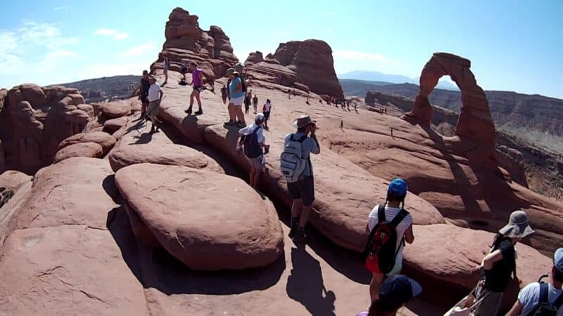
18. Delicate Arch Trail
Location: Moab, Utah Distance: 3 miles Difficulty: Moderate Time: 3 hours
Situated in Arches National Park, Utah, the Delicate Arch Trail is a short hike going up a rock face, and it ends in a climb into a deep depression in the landscape. Delicate Arch itself is on the opposite side of the bowl and provides a remarkable photo opportunity for hikers. The best time to undertake your hike is at sunset, when you can be sure to see a brilliant scene on the horizon. If you wait a bit longer until darkness, you’ll also see a brilliant display of the Milky Way, high up in the sky to remind you how small we all are.
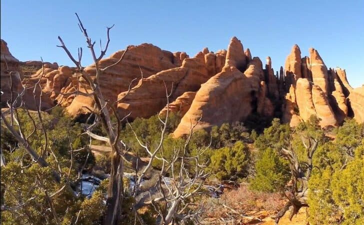
19. Devils Garden Trail
Location: Moab, Utah Distance: 7.8 miles Difficulty: Strenuous Time: 5 hours
This is one of the most adventurous trails in Arches National Park, and along the way you’ll see at least seven very different types of arches. The Devil’s Garden Trail is popular because it includes so many of these famous arches, and because it provides so many great photo opportunities. The hike itself goes through lots of sand, rocks, and it includes some of the most spectacular scenery in the entire state of Utah.
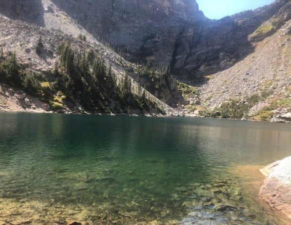
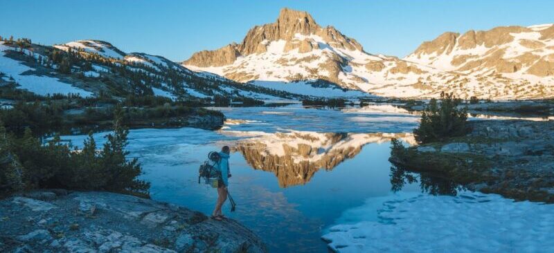
20. Emerald Lake Trail
Location: Estes Park, Colorado Distance: 3.5 miles Difficulty: Moderate Time: 3-4 hours
This is one of many outstanding hikes in Rocky Mountain National Park. For this one, hikers will begin at Bear Lake, pass by Dream Lake and Nymph Lake, before reaching the destination at Emerald Lake. Along the way, you’ll encounter some snow-capped mountains, some crystal clear lakes, and some spectacular mountain scenery throughout the entire hike. This hike will probably leave you breathless and at a loss for words.
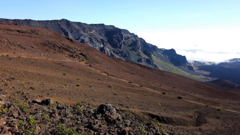
21. Sliding Sands Trail
Location: Kula, Hawaii Distance: 12 miles Difficulty: Strenuous Time: 8-10 hours
This is one of the best hikes in Haleakala National Park in Maui, Hawaii. The hike begins at the summit of 10,000 ft. Mount Haleakala volcano, and then descends almost 3,000 feet into the crater of the volcano. Since this is an out-and-back hike, you’ll have to ascend that same crater on your way out. Given the fact that this is classified as an active volcano, it might be one of the most unique hiking experiences you ever undertake.
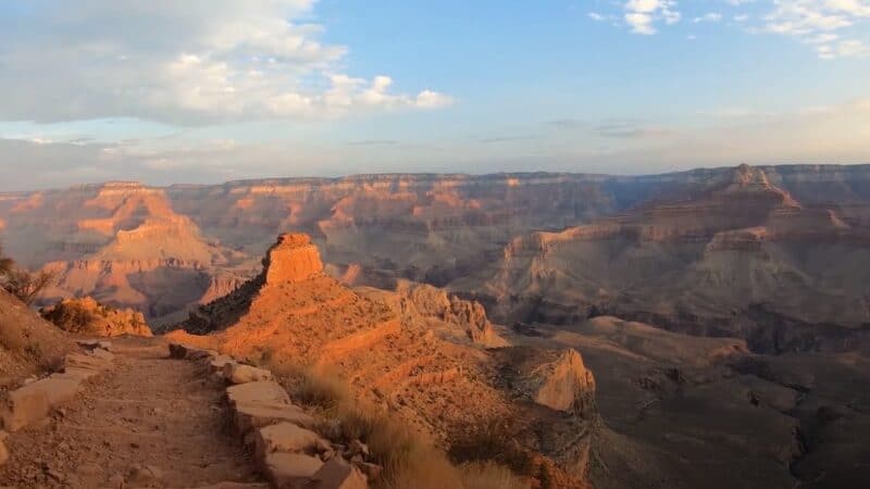
22. South Kaibab to Bright Angel Trail
Location: Grand Canyon Village, Arizona Distance: 17 miles Difficulty: Strenuous Time: 12 hours
This is practically a full day hike in the Grand Canyon South Rim, and hikers will be obliged to descend two heavily traveled hiking trails in order to reach Phantom Ranch and then head back to South Rim. On this hike, you’ll get a great view of the Colorado River carving its way through the Grand Canyon, which is one of the best scenes for photo opportunities anywhere in the country.
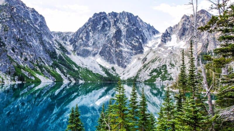
23. The Enchantments Trail
Location: Leavenworth, Washington Distance: 18.6 miles Difficulty: Strenuous Time: 15 hours
This is a very spectacular but challenging day hike in the state of Washington, and it requires hikers to ascend well over 4,500 feet all at once. This includes a huge climb up Aasgard Pass and then descending through 7,000 ft of continuously declining terrain. You’ll get a real sense of accomplishment from having completed this very difficult hiking trail, especially the last six miles, which can actually be a grueling physical effort.
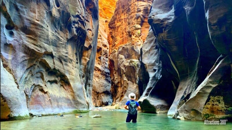
24. The Narrows Slot Canyon Hike
Location: Springdale, Utah Distance: 9.4 miles Difficulty: Strenuous Time: 10 hours
Easily the most popular hike in Zion National Park, Utah, this one has two distinct possibilities for hiking. If you opt for the top-down version, you’ll need a park permit, and if you choose the bottom-up version, no permit is required. This can be a very challenging hike, since it’s very often necessary to wade through water that is ankle-deep, knee-deep, and sometimes even waist-deep, for stretches that might go for miles. It all goes through a narrow Slot Canyon with majestic towering cliff faces, making this one of the most unique hikes in the entire country.
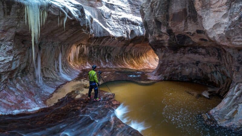
25. The Subway Trail
Location: Springdale, Utah Distance: 9 miles Difficulty: Strenuous Time: 8 hours
One of the most popular hikes in Zion National Park, the Subway Trail can be hiked either from the bottom-up or the top-down. For both of these hikes, you’ll need to get a Wilderness Permit, and you’ll need to be a skilled map reader and pathfinder. This is a true Wilderness Trail and only a few hikers are permitted on the pathway each day. That means you can expect relative isolation, and you’ll need to find your own way until you reach The Subway itself. This rock formation got its name because it’s a kind of tunnel which includes a shallow stream and a number of emerald-green pools that make for stunning photography.
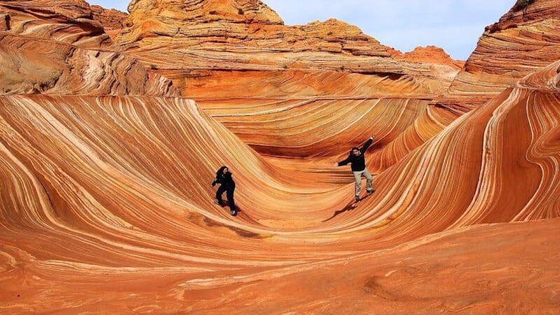
26. The Wave Trail
Location: Kanab, Utah Distance: 6 miles Difficulty: Moderate Time: 4-5 hours
Of all the hikes in the United States which require permits, the Wave Trail is by far the most popular. In fact, hikers have to win a lottery in order to get a permit for hiking the trail, and then they’ll have to go through a safety briefing and prove that they can read a map, so they are deemed competent to undertake the difficult hike. There is some very intricate typography to be negotiated during the course of this trail, including some of the most extraordinary land formations to be found anywhere.
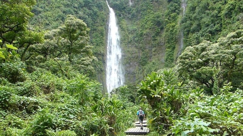
27. Waimoku Falls Trail
Location: Hana, Hawaii Distance: 4 miles Difficulty: Moderate Time: 4 hours
If you reach the Waimoku Falls along the Pipiwai Trail in Haleakala National Park in Hawaii, you will have passed through forests of bamboo, stunning banyan trees, and boardwalks overgrown with lush green vegetation. The Waimoku Falls themselves are 400 ft tall, and you’ll have some tremendous photo opportunities once you’ve navigated through all the swimming holes and eye-catching waterfalls along the way. This is a family-friendly hike that is very popular with both residents and visitors to Hawaii.
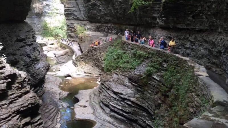
28. Watkins Glen Gorge Trail
Location: Watkins Glen, New York Distance: 3 miles Difficulty: Moderate Time: 3 hours
The Gorge Trail is a spectacular hiking trail in the Finger Lakes region of New York State. Hikers will navigate a narrow gorge using man-made walkways and some constructed staircases. On the way you’ll pass 19 waterfalls and at the trail’s end it all climaxes at Rainbow Falls. Some of the most gorgeous scenery in the country is available on this trail, and since it’s a relatively short hike, the whole family can be included on this one.
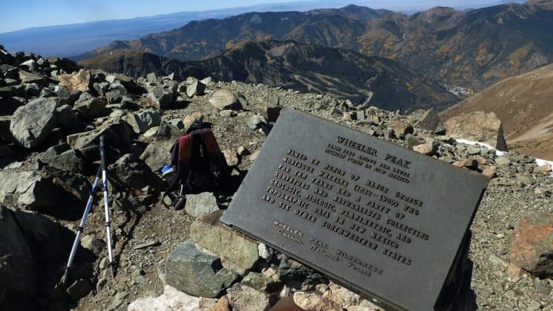
29. Wheeler Peak Trail
Location: Taos Ski Valley, New Mexico Distance: 8 miles Difficulty: Strenuous Time: 8 hours
This trail has as one of its best features, the highest elevation in New Mexico, given that Wheeler Peak stands at 13,167 ft. above sea level. This will be a very challenging ascent, but if you reach the summit, you will enjoy unbelievably spectacular views of the surrounding area. Although the first part of the trail is relatively easy, it’s followed by a steep climb on loose rocks which will prove to be a challenge to even the most skilled hikers.
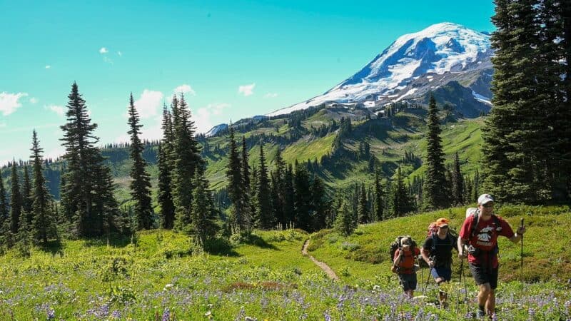
30. Wonderland Trail
Location: Paradise, Washington Distance: 93 miles Difficulty: Strenuous Time: 12 days
This is a very long hiking loop which completely runs around Mount Rainier in Washington. The 93-mile trail can be extremely challenging, since there is literally a 22,000 ft. elevation gain throughout the course of the trail. Mount Rainier of course, is a feature of unrivaled beauty in this country, and along the trail you’ll encounter some beautiful meadows of wildflowers, spectacular scenic vistas, and wilderness free of other humans. Of course, there is plenty of wildlife and other natural wonders included along the way, and that’s why this is truly a bucket list type of hike.
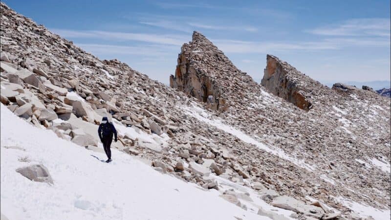
31. Mount Whitney Trail
Location: Lone Pine, California Distance: 21.5 miles Difficulty: Strenuous Time: 14 hours
This is an extremely challenging hike that lasts for 21.5 miles, and over the course of the trail itself you will ascend more than 6,000 ft. in elevation. It will be necessary to obtain a permit to hike to the summit of Mount Whitney, but assuming you get one, you’ll be rewarded with some extraordinary views in every direction. If you really want to test yourself, start training now and apply for a permit to hike to the summit of Mount Whitney.
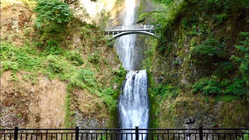
32. Multnomah Falls Trail
Location: Portland, Oregon Distance: 2.4 miles Difficulty: Moderate Time: 2 hours
If you’ve always wanted to get a glimpse of the Columbia River Gorge, your best bet may be to hike the Multnomah Falls Trail. When you reach Multnomah Falls, you’ll find a cataract that’s 620 ft tall, and is divided into two tiers. On top of the fantastic photo opportunities you’ll have with the Falls themselves, you can continue up to Larch Mountain and find three more postcard-looking waterfalls. There are quite a few waterfalls situated along the Columbia River Gorge, but Multnomah Falls is easily the most spectacular.
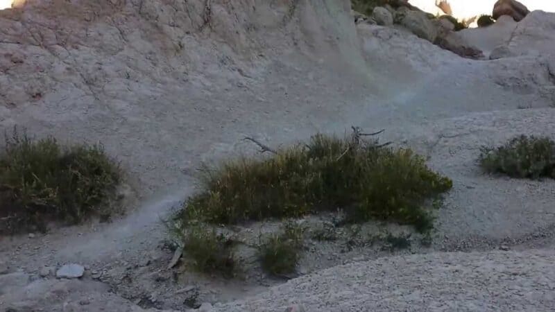
33. Notch Trail
Location: Wall, South Dakota Distance: 1.3 miles Difficulty: Moderate Time: 2 hours
One of the most adventurous hikes in all of Badlands National Park, the Notch Trail requires that you climb up a stepladder section on the Badlands Wall before reaching the rock formations at the top. You’ll be dazzled by the alien- looking landscape, and it compares well to other parks with spectacular Badlands scenery. This is a very fun and exciting hike, and since it’s also a short one, your whole family might enjoy it as well.

34. Old Rag Trail
Location: Nethers, Virginia Distance: 9.5 miles Difficulty: Strenuous Time: 5-6 hours
The Old Rag Trail is one of the really popular hikes you can take in Shenandoah National Park in Virginia. As you go through the ascent portion, you’ll be obliged to go through a boulder scramble and steep switchbacks, while also passing several false summits. Finally, you’ll reach a sign identifying this as Old Rag Mountain, and that’s when you’ll know you’re at the summit. If you like scrambling through huge boulders and rock formations, this hike along the Old Rag Trail will be just for you. While hiking, you’ll have the option of completing the loop or going back down the same way that you ascended. Most people opt for the second choice, considering the complete loop to be somewhat laborious.
35. Pacific Crest Trail
Location: Washington and California Distance: 2,650 miles Difficulty: Very Strenuous Time: 6 months
This hiking trail literally runs all the way from Mexico to the Canadian border, and it includes the most amazing mountain scenery on the North American continent. Most of the journey will take hikers through the Cascade Mountain range as well as the Sierra Nevada Range. That means you can expect plenty of photo opportunities with majestic peaks and soaring summits. One of those rare life experiences that you won’t ever be able to forget, completing this hike just once will be something you keep with you forever.
36. Precipice Trail
Location: Bar Harbor, Maine Distance: 2.3 miles Difficulty: Moderate Time: 3 hours
This hiking trail is situated in Acadia National Park, which is in the state of Maine. In order to complete this hike, it will be necessary for you to climb several metal ladders which have been constructed into the sheer face of rock walls, navigate several fields of boulders, and get through some narrow ledges, in order to reach the summit of Mount Champlain. Your heart might be in your throat for parts of this hike, since there are some scary ladder climbs along this trail that will test anyone who has a fear of heights. The entire time you’re on this height, the Atlantic Ocean will be in full view, which is one reason why this is an extremely popular hiking trail in Acadia National Park.
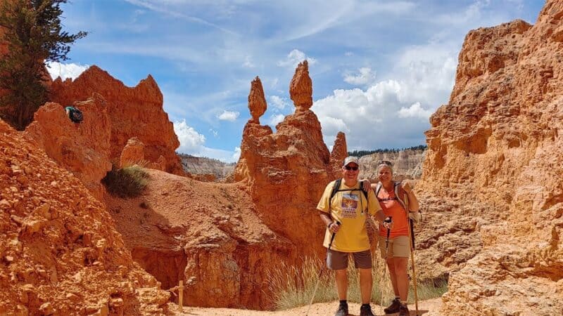
Location: Bryce Canyon City, Utah Distance: 3 miles Difficulty: Easy Time: 2 hours
This is the best hike you can take in Bryce Canyon National Park. In order to get to the Bryce Canyon Amphitheater, you’ll have to traverse a number of iconic landmarks, such as Thor’s Hammer and Wall Street. You’ll also go through a number of sandy switchbacks and quite a few twisted sandstone formations known as hoodoos. This is one of the most unique hikes you can take because of the strange landscape you’ll encounter along the way.
38. Rae Lakes Loop Trail
Location: Fresno, California Distance: 41.5 miles Difficulty: Strenuous Time: 6 days
The Rae Lakes Loop Trail is one of the more popular multi-day hikes to be found in Kings Canyon National Park. Most hikers will spend somewhere between three and six days walking and camping along the several trails included in this National Park. Before you can actually start your hike, you’ll have to get a wilderness permit from the park service. The Rae Lakes Trail constitutes one of the most beautiful sections of the Sierra Nevada mountains, and if you have the time to spare, this can be a spectacular 41-mile hike.
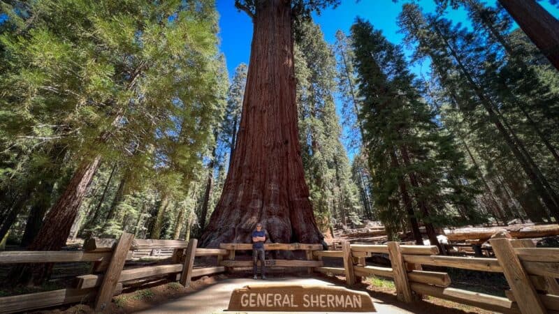
39. Sherman Tree Trail
Location: Three Rivers, California Distance: 7 miles Difficulty: Easy Time: 3 hours
This trail is situated in Sequoia National Park, and the Sherman Tree itself is considered to be the largest known tree in the world, as measured by volume. Of course, you could see this famous tree right from the road, but you’ll enjoy the experience much more if you were to take the Sherman Tree Trail and glimpse it that way. The trail goes right through the heart of the Giant Sequoia Forest, where you’ll encounter more than 8,000 giant sequoia trees. Take the whole family on this easy-rated trail and make sure you take your camera along for the tremendous photo opportunities you’ll have.

40. Silver Falls Trail of Ten Falls
Location: Sublimity, Oregon Distance: 7.8 miles Difficulty: Moderate Time: 5 hours
The state of Oregon has a gorgeous National Park called Silver Falls State Park, and in that park is the Trail of Ten Falls. The main spectacular feature here is the majestic waterfall itself, but before you reach it, you’ll pass by 10 other quite different waterfalls on a very picturesque loop through Silver Creek. The Trail of Ten Falls constitutes the entire State Park, so by hiking this trail, you should be able to see almost every noteworthy scene in the park.
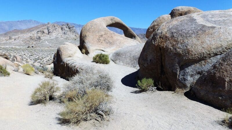
41. Mobius Arch Loop Trail
Location: Lone Pine, California Distance: .6 miles Difficulty: Easy Time: 1-2 hours
This gem of a hiking trail is situated in the Alabama Hills close by Lone Pine, California. It is a very flat and easy to hike trail which winds its way through an alien landscape of volcanic rocks, natural arches, and endless formations of strange-shaped rocks. While the Alabama Hills are not well-known themselves, the backdrop to these hills is the entire Sierra Nevada Mountain range, with Mount Whitney towering in the distance. This might be a very short hike, but it’s one of the most relaxing and enjoyable on our entire list.
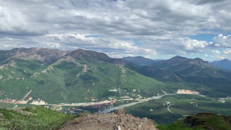
42. Mount Healy Overlook Trail
Location: Healy, Alaska Distance: 5.4 miles Difficulty: Strenuous Time: 3-4 hours
This is the best hiking trail in Denali National Park in the state of Alaska. It can be a fairly steep climb, taking you through switchbacks to the trail’s end, halfway up the mountain. Even at this height, you’ll encounter some spectacular panoramic views and snow-capped mountain peaks in the Denali Valley. It can be a windy and strenuous hike, but it’s certainly worth the effort to take in the stunning views of Alaskan mountains.

43. Mount Leconte Trail
Location: Gatlinburg, Tennessee Distance: 11 miles Difficulty: Strenuous Time: 6 hours
Mount Leconte Trail is one of the best hikes you could choose that is situated in the Great Smoky Mountain National Park, which happens to include both North Carolina and Tennessee. Before summiting Mount Leconte, you’ll navigate past Arch Rock, Alum Cave, and Inspiration Point, all of which are fantastic photo opportunities. You might be surprised to learn that Great Smoky Mountain is the single most popular National Park in this country, and the hiking trail that leads to Mount LeConte is one of the best trails within this National Park.
44. Mount Marcy Trail
Location: Lake Placid, New York Distance: 14.8 miles Difficulty: Strenuous Time: 11 hours
Mount Marcy is the highest point in New York state, which means it’s also the highest peak in the Adirondack Mountains. If you were to hike to the summit of the mountain, you’ll find it a slow and difficult trek, with more than 3,000 feet of elevation gain along the way. You might be challenged in the early part of the hike, but if you make it all the way to the destination, you’ll be rewarded with some magnificent summit views. The top of Mount Marcy is 5,244 ft above sea level, and you’ll be able to observe Canada’s Mount Royal, the Adirondack High Peaks, and Vermont’s Green Mountains on a clear day.
45. Mount Pilchuk Trail
Location: Granite Falls, Washington Distance: 5.4 miles Difficulty: Moderate Time: 5 hours
If you complete this hike, you’ll find yourself at a wooden fire watchtower with a spectacular view over parts of the state of Washington. Mount Pilchuck is not included in one of the nearby national parks, but it’s still a very popular hiking trail. It has a short but steep trail that ends with an unobstructed view of all the landscape below. There are quite a few interesting hikes in the state of Washington, but most serious hikers agree that Mount Pilchuck is one of the best of all of them.
46. Mount Storm King Trail
Location: Port Angeles, Washington Distance: 4 miles Difficulty: Strenuous Time: 4 hours
This hiking trail is situated in Olympic National Park in the state of Washington. In just two miles of hiking, you’ll go up 2,000 feet in elevation as you approach the summit of Mount Storm King. There is one section near the end that requires the use of ropes, so only experienced hikers should attempt this trail. If you do make it to the summit of Mount Storm King, you’ll be dazzled by the spectacular scenery around Lake Crescent, and the surrounding terrain is just as amazing.
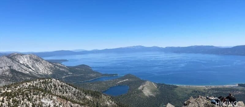
47. Mount Tallac Trail
Location: South Lake Tahoe, California Distance: 10.5 miles Difficulty: Strenuous Time: 8 hours
The tallest mountain on the shoreline of Lake Tahoe, California is Mount Tallac, which stands at 9,738 ft above sea level. This provides the very best observation point above Lake Tahoe from the southwestern shore. If you’re looking for a sweeping view of a crystal-clear lake, this is a hike that you should definitely go on. It may be rough going for a while, and it will probably take up most of a day, but it’s well worth it when you see the spectacular landscape at 10,000 feet.

48. Mount Washburn Trail
Location: West Yellowstone, Montana Distance: 6 miles Difficulty: Moderate Time: 5 hours
Mount Washburn constitutes one of the most hiked trails in Yellowstone National Park, if you exclude the geyser basin trails. On this hike, you’ll have a gradual climb that eventually takes you to the summit of Mount Washburn, which stands 10,219 ft above sea level. Here you’ll be able to observe the endless vistas of mountain peaks as well as the Grand Canyon of the Yellowstone. You may want to avoid the more crowded geyser basins in Yellowstone National Park and hike up the Dunraven Pass on your way to Mount Washburn. On this day hike, you might very well spot some bears, bison, or bighorn sheep.
49. Mount Washington Trail
Location: Gorham, New Hampshire Distance: 7.5 miles Difficulty: Strenuous Time: 8 hours
Mount Washington is the tallest peak in New Hampshire’s White Mountains, and that also makes it the highest peak in all of New England. It’s extremely windy near the summit, and that’s what has earned Mount Washington a reputation for being the most dangerous small mountain in the world. In 1934, a wind gust of 231 mph was recorded at the summit of Mount Washington. If you successfully complete this hike, you will have climbed 4,000 feet in just 3.8 miles, under universally difficult hiking conditions. Give yourself a gold star if you can complete this hike, because it constitutes a major achievement.

50. Mount Whitney Trail
Location: Lone Pine, California Distance: 21.5 miles Difficulty: Strenuous Time: 14 hours
Mount Whitney is the tallest mountain peak in the Sierra Nevada Mountain range of California. This is an extremely challenging hike of 21.5 miles round trip, and along the way you’ll be obliged to ascend 6,100 feet in elevation gain. It will be necessary for you to obtain a permit before hiking to the summit. If you’re a serious hiker and really wish to challenge yourself, this is one of the best hikes you could take in the state of California, and possibly in the entire United States as well.
You can also read:


